2021 Planting Report
Samuel and Edna Hill Preservation Site
|
By Matthew Nugent, Nachusa Grasslands Resident Fellow
Excerpts from the planting report: Introduction This planting was done by The Nature Conservancy’s Nachusa Grasslands hired seasonal crew. Nearly a ton of seed from 192 species were hand collected all summer through the fall. The seed was milled at the Nachusa seed barn, with various mixes of seed made. Nachusa Grasslands Resident Fellow Site Conditions
General Location – 1-mile South of Grand Detour Bridge on Eastern edge of Route 2 GPS: 41.882035 -89.427670 Acreage: 18 Elevation: 716-740 ft County: Ogle Topography The MRCP Hill Site has a varied topography. To the North there is a bare and sandy hilltop beginning along the main East-West two track. Further south, there is a smaller hill that is again barren and sandy. Along the western edge of the planting there is a ditch running along Route 2 with some drainage and lower wet areas within the planting. The South-Eastern edge of the planting has another low spot consisting of some wet areas. To the North and North-East of the planting there are various hills with wooded areas. Agricultural History This site has been under an agricultural management system for seemingly decades. The soil structure has been broken and seems to have massive structure. Upon inspection of the site some of the areas have damage due to soil compaction along the Western edge. Within the hills, erosional gullies have formed due to loss of soil structure and bare soil becoming susceptible to erosion. Large stones within the planting have scratches related to tillage implements. Surrounding the planting, the woodlands seem to have been left without any forestry or timber management as the understory was closed due to overcrowding and Honeysuckle. It will be an incredible journey for this site to recover. Site Preparations The site preparations began the week of November 1st and continued until the first day of planting on November 4th. Site preparations began online as the Crew had used the USDA Soil Survey to gauge an idea as |
to what the hydrology, soil texture, and topography were like. The next step was the application of Google Earth Pro to create a color-coded map to classify areas needed per seed type (Dry, Dry-mesic, Mesic, Wet). A trip to the site was made after the seed-type classifications were decided upon in order to make sure the computer model worked with the physical properties found on site. Minor changes were made to adjust for some topography and unforeseen shading due to the South-Western wooded and shaded border. Seed-type area classifications were marked via flags and a cruise around the perimeter of the site was conducted to clear litter and debris. The site did not require any mowing as the soybean residue was easy to drive through and plant over. Aside from removing a few medium sized boulders, there was no landscaping, scraping, or dozing at this site. The seed mixes were created November 3rd and were decided upon by Crew Leaders Matt Nugent and Anna Scheidel. Decisions were based upon working knowledge of plants. The seed mixes were then hand mixed by crew via pitchfork, weighed, sorted, and loaded onto the livestock trailer for transport.
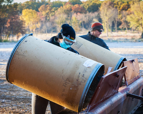
Planting the Seed Planting began November 4th and was completed on November 8th. Some surplus step-in seeds were planted on November 18th. The weather was modest during the initial planting: sunny, no precipitation, low winds, and around 40 degrees. The final round of step-in seeds was planted on the 18th and involved strong winds of 20 mph and windchill. Planting Mixes Over the 2021 season, the crew handpicked in total 1,766.104 pounds of seed made up of 192 different species. The crew created a Dry, Dry-Mesic, Mesic, Wet, and Woodland Mix. |

